**In times of crisis there is nothing that can map a disaster situation on the ground quite as fast and accurate as OpenStreetMap. As NGO's in developing countries find their way to open geodata, they want to use the data for their daily work as well as to be ready for when disaster strikes.
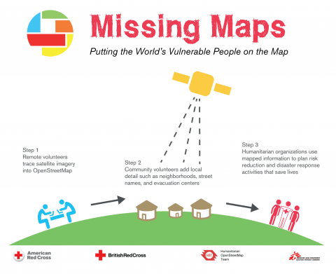
That's where the Missing Maps project comes in. Most of the current OSM mappers are based in Europe, mapping their own neighbourhoods. But they can also help out in the huge task of mapping everything that can be seen on satellite pictures. By building a basemaps with roads and villages, local communities can quickly add names and points of interest. This work is coordinated through the Tasking Manager.
It's something that not just mappers but everyone can do. We invite you to work on this task together during a Missing Maps Mapathon. We will teach you how to identify features, and how to add them to the global OpenStreetMap dataset. By the end of the afternoon, we'll have mapped quite a bit of land - with open data and maps available worldwide, seconds after you save them to the database.

So joing us our mapathon in Gent on January 23th!
We will map an area in Africa selected by the Missing Maps team, where villages and roads are still missing from OpenStreetMap. This will create the basemap that people whit local knowledge can further enrich, while being an easy task for beginners.
What should I bring to a mapathon?
A laptop, a computer mouse and cartographic enthousiasm! If you have any special needs, please let us know during the booking process. Should I be a cartographer, mapping or computer expert? No, mapping for Openstreetmap is for everyone! We will be giving an introduction for newbies.
Where is the event?
At the Vredeshuis (Peace house), Sint-Margrietstraat 9, 9000 Gent.
Schedule
- 13.00: Start & welcome!
- 13.15: Introduction on the Missing Maps, Openstreetmap and Stad Gent support
- 13.30: We'll form two groups: Beginners: full introduction to mapping in Openstreetmap.
- 17.00: We have the space until this time.
Experienced Mappers: start your mapping!
Where do I sign up?
Register here and be there! Participiation is free, the mapathon team just wants to know how many people to expect.


Share